
Independent analysis, open to all, fast enough to act on.
Our Mission
Satellite data, coupled with socioeconomic indicators and market insights, powers near-real-time expert agricultural assessments. We work with food security experts around the world to help decision-makers respond effectively and reduce the risk of future crises.
Our Values
Scientific Rigor
We anchor our assessments in data-backed evidence and quantify our uncertainty, bringing together AI and expert knowledge.
Transparency & Accessibility
We put agricultural insights within everyone’s reach, openly sharing our methods and sources.
Public Good
All of our assessments are user-driven. We publish for the world, not a privileged few.
Innovation & Ambition
We have launched a global system for rapid response that is fast, scientifically routed, and action-oriented.
RAAPID brings together traditionally siloed communities across national security, markets and trade, and humanitarian development to strengthen shared understanding and enable faster, more informed action.
RAAPID has already delivered critical assessments across the globe spanning conflict (Ukraine, Sudan, Democratic Republic of Congo, Ethiopia-Tigray), climate shocks (Pakistan, Malawi), and market uncertainty (Russia, China). These assessments have helped close critical information gaps, inform policy decisions, and support targeted interventions where timely, reliable data was not otherwise available.
Extreme weather events, conflict, market volatility, and geopolitical fragmentation are increasingly interacting - producing shocks that ripple rapidly across food systems, supply chains, and livelihoods.
Using AI and satellite data, combined with expert knowledge, we turn complex information into actionable agricultural intelligence.
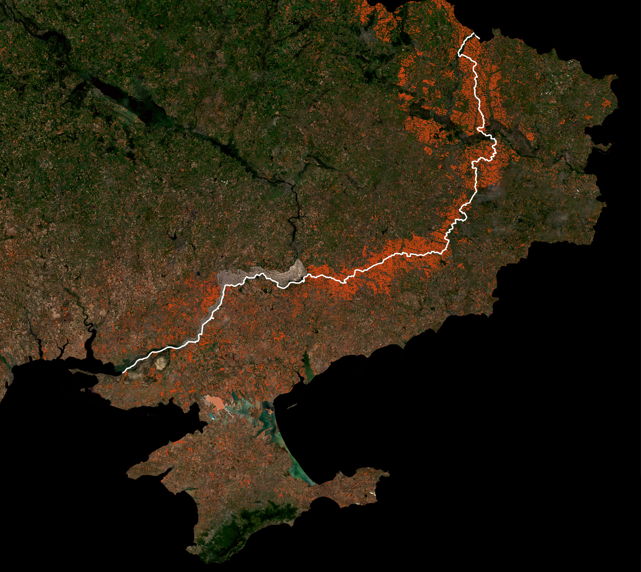
RAAPID analyzes changing planting patterns across the Black Sea Region in both Russian-occupied and Ukraine-held territories (source: NASA Harvest, Planet, Institute for the Study of War)
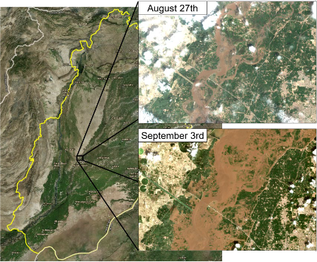
RAAPID assesses flooding along the Chenab River in Punjab, Pakistan. Satellite imagery shows significant flooding to agricultural land between August and September, 2025. (source: NASA Harvest)