
Conflict Response: Ukraine War
Since the onset of the Russia–Ukraine war, we have leveraged satellite data to provide timely, objective agricultural intelligence, helping Ukraine and the international community monitor crop production, assess conflict impacts, and support critical food security decisions.
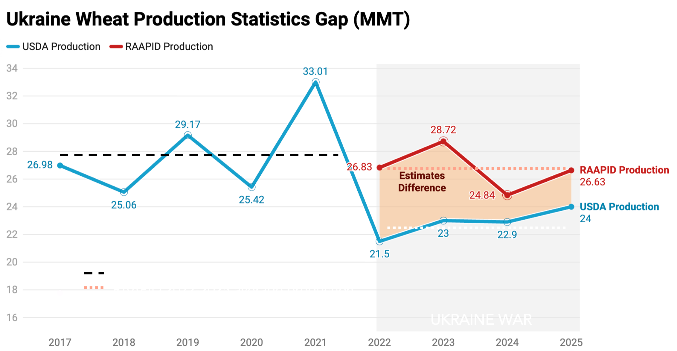
Closing a multi-million ton gap in agricultural intelligence.
At the request of the Ministry of Agrarian Policy and Food of Ukraine, RAAPID is helping assess the impacts of war on Ukrainian held and Russian-held territories.
Agricultural production estimates in Russian-held territories of Ukraine remain highly uncertain, creating a significant gap in global food security intelligence. Our satellite-driven assessments indicate crop production levels remain close to pre-war estimates (~26.8 million metric tons compared to ~27.9 million metric tons before the war), while official statistics suggest a sustained decline to approximately ~22.5 million metric tons.
By leveraging remote sensing, AI, and advanced analytics, RAAPID provides independent, timely assessments that help reconcile data gaps, improve transparency, and support evidence-based decision-making in complex and rapidly changing environments.
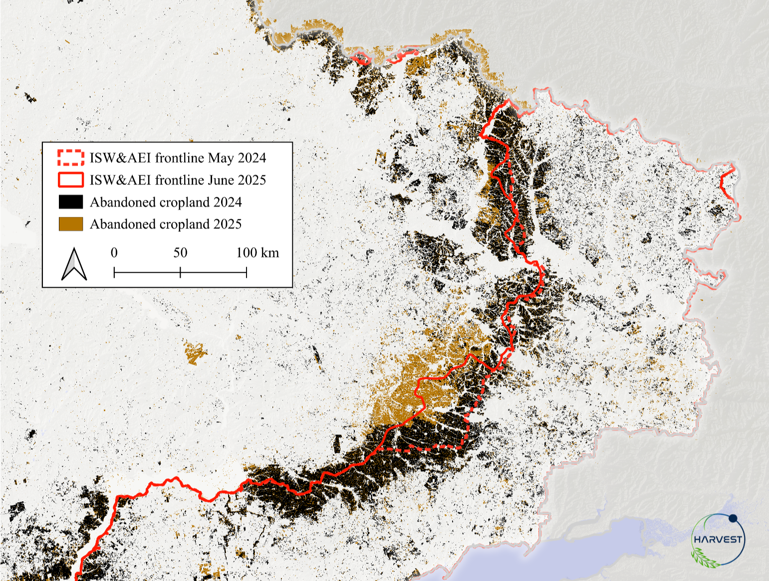
Significant swaths of cropland are being abandoned.
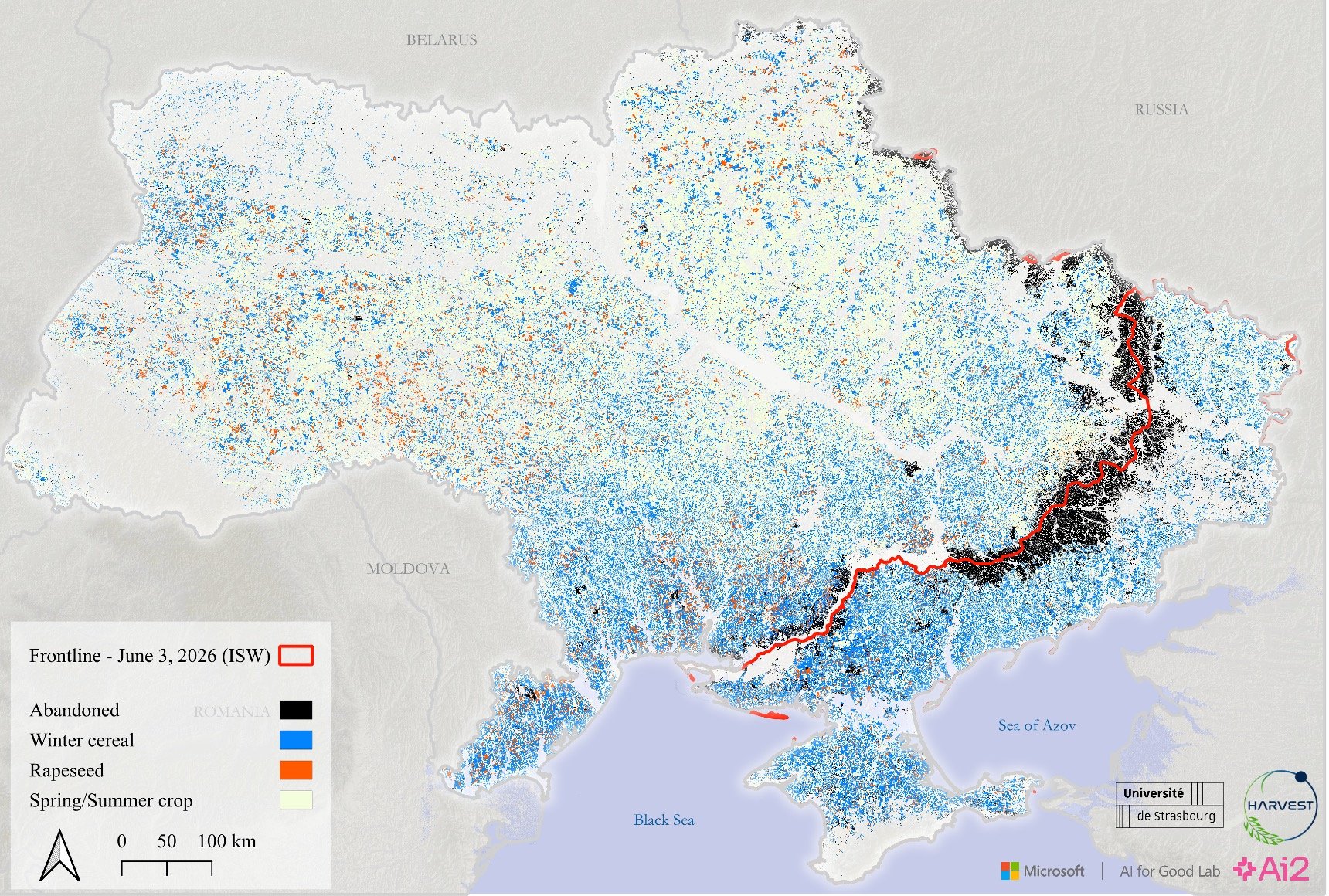
The war in Ukraine has disrupted agricultural production across the country, leaving significant areas of cropland uncultivated. Our analysis estimated that approximately 7% of Ukraine’s total cropland was abandoned in 2023 due to conflict-related disruptions. This loss of productive land represents an estimated $2 billion in foregone agricultural output, highlighting the economic and food security consequences of the war.
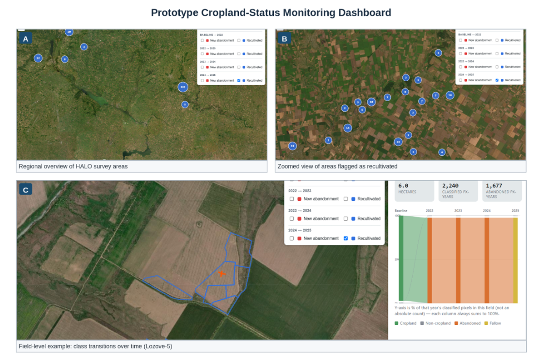
Supporting humanitarian de-mining efforts.
The presence of unexploded ordnance (UXO) across Ukraine poses a significant barrier to agricultural recovery, limiting farmers’ ability to safely access and cultivate impacted lands. Through collaboration with The HALO Trust, RAAPID is leveraging satellite data and geospatial analysis to support efforts to identify areas at risk from landmines and other explosive remnants of war.
These satellite-driven insights help inform humanitarian de-mining operations, prioritize field assessments, and accelerate the safe restoration of agricultural land. By integrating Earth observations with on-the-ground expertise, RAAPID supports faster, data-informed responses to one of the most complex challenges facing Ukraine’s food systems.