
Conflict Response: North Kivu (DRC)
We use satellite data to assess changes in cultivation in North Kivu (DRC) during the 2022–2023 conflict compared to pre-intensification levels in 2021.
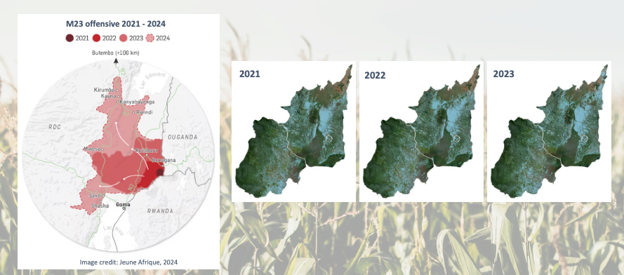
Land use changes in the face of conflict.
At the request of FEWS NET, RAAPID was tasked to assess how escalating conflict in the DRC was affecting agricultural production in areas where ground-based information was increasingly limited. The analysis provided a more nuanced picture of crop conditions than anticipated, helping identify where agricultural disruption and food insecurity risks were—and were not—materializing.
As conflict intensified in the Democratic Republic of the Congo (DRC), we worked with regional partners, analyzing crop conditions in conflict-affected areas using Earth observation data, vegetation indicators, and agricultural monitoring techniques. The team evaluated how displacement, restricted access to farmland, and ongoing violence affected crop production, helping identify regions at greatest risk of agricultural disruption and food insecurity.
These assessments complemented traditional reporting by providing consistent, independent monitoring in areas where ground observations were limited or unavailable. Using this critical agricultural information, RAAPID helps humanitarian actors and decision-makers better target support to communities facing the greatest risks from conflict-related agricultural disruption.